Kanariya-zaka Hill – A Chirping Descent Through Hatanodai
🐦 Kanariya-zaka – A Name from Another Era
Kanariya-zaka (カナリヤ坂) winds through a quiet residential area of Hatanodai. The name, which means “Canary Hill,” dates back to around 1955, when two locals—the principal of Ebara Daini Junior High and a nearby pet shop owner—chose it together. They wanted something cheerful. After discussing several birds, they settled on the canary for its light-hearted image. Although the pet shop has vanished, and the people behind the name are long gone, the name itself still lingers.
🛣️ A Road with Texture
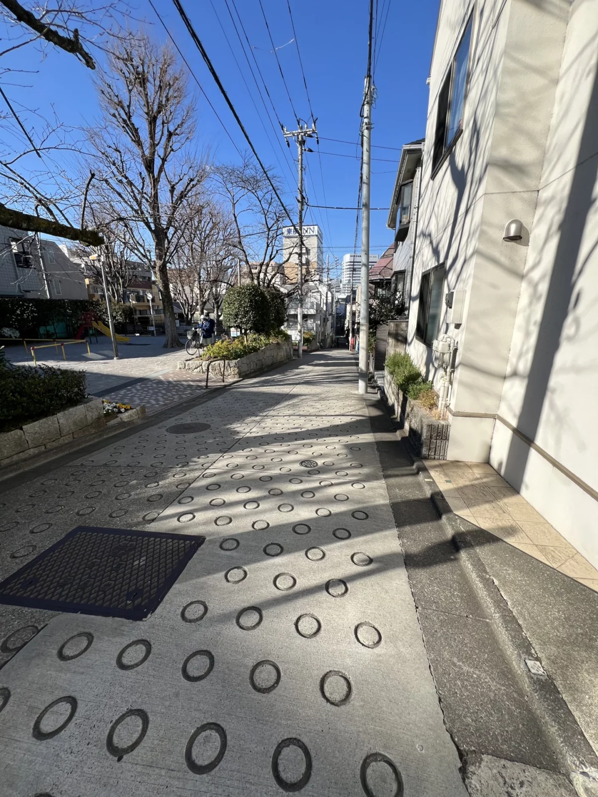
Look down and you’ll notice a field of shallow circular indentations pressed into the concrete slope. These O-shaped antislip grooves—O-gata suberidome (O型すべり止め), commonly known as O-ring paving (Oリング舗装)—represent a uniquely Japanese response to a practical challenge. Engineers at Taiheiyo Precast Concrete Industry introduced the design in the 1950s to improve traction on steep roads, especially when wet. At first, they tested square shapes, but circles proved much easier to remove from semi-dry concrete. Thanks to this efficiency, construction teams quickly adopted the method. The result: a surface that is subtle, useful, and standardized—just like many parts of daily life in Tokyo.
“A worker walks the length of the slope, setting rubber rings into the fresh concrete by hand. Once vacuumed and dried, the rings are pulled out—leaving behind Japan’s quietly iconic antislip pattern. It adds 15% more grip. It prevents countless slips. And it tells a story of engineering in a land where most roads lean downward.”
Nagato Abe, Toa Road Corp. (via Japan Times)
Today, Kanariya-zaka serves the everyday routines of locals. You won’t find monuments or dramatic scenery here. However, the slope carries a small piece of mid-century memory. In Japan, a story embedded in a name often holds more meaning than anything visible at first glance.
🧭 Kanariya-zaka Visitor Information
Address: Near 5-chome, Hatanodai, Shinagawa-ku, Tokyo
Best season: Spring and early autumn offer the most pleasant stroll
Admission: Free
Official Info: Shinagawa City Official Website
Where is it?
| what3words | ///hills.slate.rested |
| latitude longitude | 35.6044157, 139.6941845 |
| Nearest station(s) | Hatanodai Station (Tokyu Oimachi and Ikegami Lines) |
| Nearest public conveniences | The station or nearby convenience stores. |
Show me a sign.

The Hyakkei sign is posted partway down the hill near playground. It gets a bit overgrown during the summer.
Withervee says…
This slope doesn’t stand out, and it likely never meant to. Still, I admire that someone once gave it a name—a simple gesture from a school principal and a pet shop owner who cared about their neighborhood. Today, there’s a dentist, a playground, and a few quiet houses. The pet shop is gone, but the road remains. So does its name. And as I walked, I kept noticing the circles in the concrete—one after another—like the slope itself had been marked: correct, correct, correct.
Site Character
- Lifestyle 生活 (Seikatsu): ✔️
- Historical Significance 歴史 (Rekishi): ✔️
- Atmosphere/Natural Features 風土 (Fūdo): ✔️
Who in their right mind would vote for this?
- Locals walking the daily slope
- Fans of lost Showa-era shops
- Writers and urban storytellers
- People who like slope signs
- Those prone to slipping
Further reading
Indented Circles on Roads – Japan Times
While you’re there…
While exploring the area, you can also visit Hatanodai Fushimi Inari Shrine with its red torii and guardian foxes, or step into the grounds of Horenji Temple. If time allows, visit its neighbour Hatagaoka Hachiman Shrine and Kamakura Road, a site tied to old travel routes and neighborhood tradition.